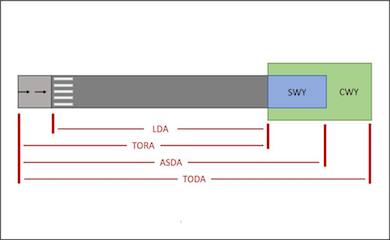
Runway Declared Distances
Background Declared distances are specific lengths of runway that are published for aircraft operations, specifically when taking off or landing, and are defined for pilots to understand their allowable take-off and landing weights and speeds. The declared distances for a runway comprise the Take-Off Run Available (TORA), Take-Off Distance Available…

Is the Aviation Industry Exploiting a Loophole?
Carbon Emissions and Airline Responsibilities Guidelines and targets for carbon emissions are politically – and scientifically – important in 2020, and they will likely remain important in the future. For every initiative to reduce our emissions, there appear to be a slew of exceptions, loopholes and accounting tricks that can…
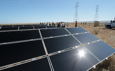
Solar Panel Glare
Overview Solar Panel Glare occurs even though it is not expected because solar panels are designed to absorb sunlight, rather than reflect it. Solar Panel Glare is greater than expected because panels are good at absorbing light perpendicular to them but much less effective when the light is at a…
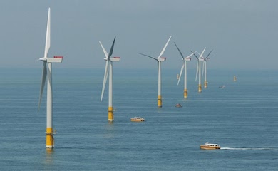
NATS Offshore Wind Farm Assessments
Background NATS operates a network of radar that allows it to control and monitor air traffic across the United Kingdom and its surrounding waters. As a result of the Hornsea wind farm appearing on its screens unexpectedly it is revising its wind farm assessment process. Figure 1 Greater Gabbard Offshore…

Aerodrome Safeguarding – The Transitional Surface
Background Buildings and structures can present a collision risk to aircraft using particular airports. Airports and airfields are often consulted regarding developments in their vicinity. Aerodrome Safeguarding Assessments can be undertaken for civil airports, military airbases and smaller airfields. Airports are protected from surrounding development by a system of Obstacle…
Digital Elevation Models (DEM)
When using digital elevation models data we often come up against terms like DEM, DTM, and DSM. Often they can be confusing and also misinterpreted to mean the same thing. In this article we attempt to quickly explain what each terms means and hopefully help clarify some key points. Figure…
What is a Fresnel Zone?
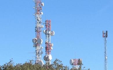
Wireless Links Wireless communication systems are ubiquitous throughout the UK and many other countries. Typical uses include mobile phone networks, whereby individual masts are connected to the wider network via point-to-point communication links. Figure 1: Microwave link antennae – Spain Interference Links between two antennae function best with a clear,…
What is a VHF Omnidirectional Range (VOR)?
Developments worldwide can receive objections from numerous sources, including Air Navigation Service Providers (ANSPs). Often such objections are related to radar interference, however issues can also be raised due to potential impact on VORs. ‘VOR’ stands for ‘Very High Frequency Omnidirectional Range’. Overview of VOR VOR is a navigation system…
How can we help you today?


THE SECTORS WE SERVE


LATEST TWEETS
This article will explore the current opportunities for solar panels on new builds in the UK: https://www.pagerpower.com/news/shining-a-new-light-the-regulations-for-installing-solar-panels-on-new-buildings-in-the-uk-today/
#solar #solarpanels #solarpanelinstallation #newbuildings
Radar constraints are an old and persistent nemesis for onshore wind developers. This article presents an overview of the most commonly encountered hurdles for onshore developers in this regard as they pertain to civil radar interests. Learn more:
In this article, we take a look at our Broadband Connectivity Assessments, when they are required and what they involve. Learn more: https://www.pagerpower.com/news/broadband-connectivity-assessments-to-maximise-planning-success/
#broadband #broadbandconnectivity #broadbandassessment #buildingdevelopment #FTTP